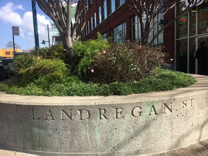
 “Landregan St” is still stamped in the concrete planter box of the EmeryStation campus facing Horton at 59th street.
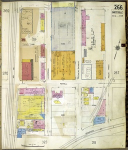
Landregan Street once existed where Horton Street is now between Stanford and 59th streets.
There was previously a railroad track along Stanford Avenue which Horton Street did not cross. Landregan was a dead-end street that went south from 59th and ended at those tracks.
The City had a goal of creating a continuous street parallel to Hollis to take some of the traffic pressure off Hollis Street. Several things happened in the late 1990s/early 2000s to help make that happen.
One of the conditions of approval of the late 1990s Chiron development was that they extend Horton Street across the railroad tracks at Stanford and connect it to Landregan Street. Also, when Wareham built the EmeryStation complex in the early 2000s, they extended Landregan north from 59th to 62nd Street (The reason for the “swerve” just north of 59th is to avoid the asphalt “cap” that was containing the contamination on the old Amtrak parking lot.)
At some point in the early 2000s, the City of Emeryville decided to rename Landregan to Horton for continuity.
Also in the early 2000s, when the Courtyards at 65th Street apartment complex was built, they extended Overland Avenue north from 64th Street to 65th Street. The end result was a continuous street parallel to Hollis south from 65th Street all the way to 40th Street and Mandela Parkway, being Overland Avenue from 65th to 62nd, and Horton Street south of 62nd.


